Issues with GPS
(Intro from Wikipedia)
Assisted GPS (abbreviated generally as A-GPS) is a system that can in many cases greatly improve the startup performance or time-to-first-fix (TTFF) of a GPS satellite-based positioning system. It is used extensively with GPS-capable mobile phones, as its development was accelerated by the U.S. FCC's 911 requirement to make the location of a cell phone available to emergency call dispatchers.
Assistance falls into two categories:
- Mobile Station Based (MSB): Information used to acquire satellites more quickly
- It can supply orbital data or almanac for the GPS satellites to the GPS receiver, enabling the GPS receiver to lock to the satellites more rapidly in some cases.
- The network can provide precise time.
- Mobile Station Assisted (MSA): Calculation of position by the server using information from the GPS receiver
- The device captures a snapshot of the GPS signal, with approximate time, for the server to later process into a position.
- The assistance server has a good satellite signal, and plentiful computation power, so it can compare fragmentary signals relayed to it.
- Accurate, surveyed coordinates for the cell site towers allow better knowledge of local ionospheric conditions and other conditions affecting the GPS signal than the GPS receiver alone, enabling more precise calculation of position.
Issues with A-GPS
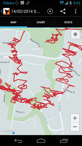
I had used my Android in New Zealand and then returned home to Brisbane (2,500km NW of where I had been in New Zealand). I had not allowed data roaming in NZ.
Upon my return, on a clear day, with good GPS reception, the track I recorded is shown in the above screen print!!
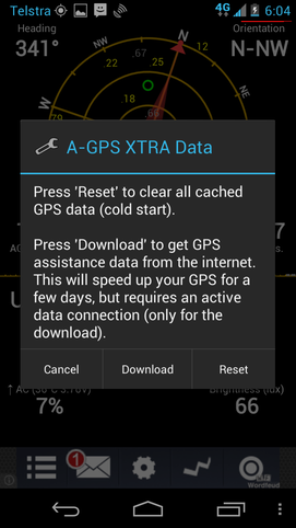
To remedy this, I used an app to re-download GPS assistance data and this corrected the issue immediately.
I used the "GPS Status & Toolbar" app from MobiWIA. This includes functions to manage the Assisted GPS functions. I found that if if I reset the A-GPS nothing changed. But if I used "Download" the issue was fixed immediately.
There are many A-GPS Apps available a more recent one is: Android is "Test GPS" https://play.google.com/store/apps/details?id=com.chartcross.gpstest
Also see an article from Strava on GPS:
Issues with Fused Location Provider
Google uses a “fused” location provider https://developers.google.com/location-context/fused-location-provider
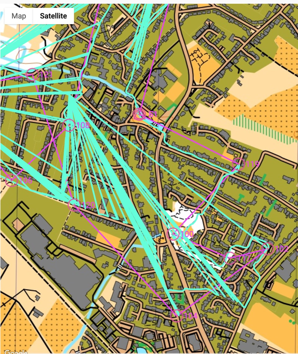
This blends location data from satellite, cellular and wifi. On rare occasions we've seen it where when the phone is not getting a good satellite signal, it can drop back to cellular or wifi locations.
If this is the case you may see the location periodically jumping to a fixed point … which is probably a non-satellite data point. This may be more prevalent where the phone may be off-line (ie no SIM or no Data) and it tries to look for known Wifi networks. Or potentially if the phone battery charge it low, a battery saver function may start to restrict the use of the GPS. See an example below.
| gpx_track_issues_v1.jpg |
GPS Watches
See some interesting analysis of GPS issues at the following link: fellrnr.com/wiki/GPS_Accuracy