MapRun Version 7
MapRun version 7 is the recommended version of MapRun, offering enhanced features over MapRun6. See details.
MapRun version 7 install links:
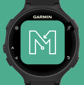
MapRunG runs on a Garmin Watch and works in conjunction with MapRun6. If you'd rather not carry your phone, use a Gamin Watch like a ForeRunner 245 instead....
Please only use MapRun consistent with any local Covid-19 lockdown restrictions. Overview of MapRunMapRun is a new format of running for fun and fitness.
It is a form of Orienteering that uses SmartPhones for punching and timing, avoiding the need to put flags and SI units out on the course:
Events are published by organisers and can be selected from a menu in the App. Download the free MapRun App and give it a try. Like us on Facebook: @mapruns Getting Started - Setting up your own Event |
MapRun is free to use by individuals. It is operated and maintained by volunteers, but there are costs for services and licences (via FNE Enterprises). Please consider if you or your club can contribute to the ongoing operation of MapRun. See details.

|